
Saratoga Arms’ evening front desk manager, Jeff Apple, is an avid hiker. On his days off, he is usually on top of a mountain…far, far away from cell phone coverage. Jeff has offered to share blog posts of great hikes in and around our Saratoga Springs, NY hotel. He starts off our six part series by discussing these hikes, from easiest to most challenging. The first installment was Geyser Creek Trail, which is 2 miles from Saratoga Arms. His second post featured a beautiful hike in the Lake George Area at Sleeping Beauty. His third installment is a favorite of our guests, Hadley Mountain. For the fourth installment, a local favorite, Buck Mountain. And for his 5th blog…Prospect Mountain. He finishes up with a difficult hike-Crane Mountain.
The Mountain
Over a century ago in the early 1900s, New York State staffed a network of towers on mountain peaks to search for and keep tabs on forest fires. However, beginning in the 1980s, the use of these fire towers began to be phased out. In 1990, the last five towers still in operation were closed and over time, deteriorated and were dismantled. Nearby Crane Mountain is one of the mountains that had its fire tower removed. At its summit, you can still see the footprint and anchors for the tower and make out where the foundation of the caretaker’s cabin was.
Stay in the heart of downtown with easy access to Crane Mountain and many other Saratoga Springs NY hiking trails. Pick your favorite room and then Pick Your Path! Add this fun choose-your-own-adventure package to your reservation and don’t forget to pack your best pair of walking shoes, or hiking boots!
Book Now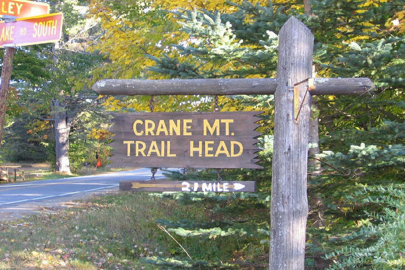
The Climb Up
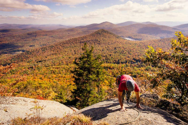
At an elevation of 3,254 feet, Crane Mountain is the tallest in our series of hikes. The shortest route to the summit is 1.4 miles with an ascent of about 1,150 feet, making for a steep, thigh-burning climb. Even during the drive in, the mountain’s magnitude and steepness is impossible to ignore.
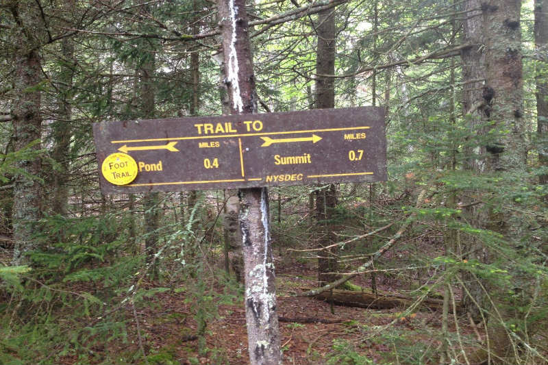
The dirt road to the trailhead ends at a lot that can hold about a dozen cars. Head to the right out of the parking lot and sign the trail register to begin the hike. The trail rises sharply almost from the very beginning. At first, you’ll climb up an incline weaving through large boulders and a steep talus field. At 0.5 miles, this seemingly relentless ascension levels off for a moment. To the left, there is an open ledge with great views that makes for a fine resting spot. Shortly after, at 0.7 miles, you’ll encounter the first trail junction. Continue to the right here to push on towards the summit; the left trailheads to Crane Mountain Pond, which we will visit on the return trip.
The rest of the trail to the summit is much easier than that first incline, helped by a pair of sturdy wooden ladders that add to the adventure. You’ll soon come to a small ladder of about 6 feet. After that, the trail turns to the right and skirts the outside of the final cliff for a few tenths of a mile. It sharply turns to the left to encounter a large approximately 25-foot ladder that takes you most of the rest of the way to the top.
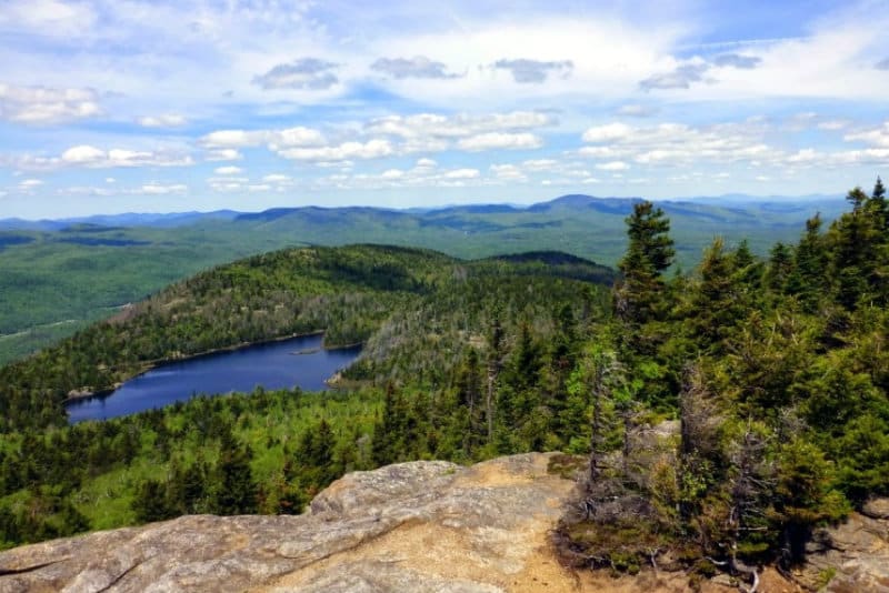
The summit is large, rocky, and open, with exceptional views. This is a great place to enjoy a picnic lunch and a short rest sunbathing on the rocks. Continuing past the summit about 0.3 miles. The trail will begin to descend towards our next destination: Crane Mountain Pond.
FREE Hiking Guide of the Adirondacks!
The Descend Down
The trail down to the pond is predictably steep, descending about 500 feet in a half mile, but presents a nice spot to rest your knees and cool your feet. There are a few popular backcountry campsites around the pond and there are spots where flat rocks come right down to the water’s edge, making it easy to go for a quick swim.
Following the trail along the left side of the pond, you’ll come to a three-way intersection. If you head left, in 0.4 miles you’ll come to the intersection we encountered earlier before reaching the summit, and you can hike back out the same way you came in. If you head straight, the trail departs the pond near its outlet and travels down the mountain along Putnam Brook. The latter option is a little over a half mile further but is a tiny bit less steep. Depending on which route you take on the way back, this hike is a pretty intense 4-5 miles and should take around 4 hours. It is the most difficult trek in our hiking series and I would only recommend it to people with prior hiking experience, but the rewards are well worth the efforts.
Directions
To reach the trailhead for Crane Mountain
- Head North on I-87 to Exit 23.
- Turn left off the exit, then right onto Rt. 9.
- In about a half mile, turn left onto Richards Avenue and cross the Schroon River.
- Turn right onto River Street.
- In 3.6 miles, turn left to stay on River Street.
- In 0.3 miles, turn right onto Athol Road.
- Keep right for 3.2 miles to stay on Athol Road, then turn left onto Valley Road.
- In 4.6 miles, turn left onto Garnet Lake Road.
- Follow for 1.3 miles, then turn right onto Ski Hi Road.
- Ski Hi Road steeply ascends to a gate. Turn right and the parking lot is 500 feet away.